
Skynet E-Solution provides advanced geospatial solutions using modern technologies including GIS, Remote Sensing, Drone Mapping, and DGPS survey systems.
We specialize in generating high-accuracy spatial data using satellite and drone imagery.
Our services include Land Use Land Cover (LULC) mapping, change detection analysis, enumeration studies, environmental assessment, surveying, and mapping services for government and private sector organizations.
Our expertise also includes drone-based mapping using high-quality RGB and LiDAR payload sensors, enabling high-resolution terrain modeling, Digital Elevation Model (DEM) generation, and accurate geospatial analysis to support planning and informed decision-making. we are experts in developing WebGIS portals and geospatial platforms that enable interactive visualization, spatial analysis, and Decision Support Systems (DSS) for organizations to efficiently manage, analyze, and monitor spatial data.


Harnessing the power of Spatial Data & Remote Sensing
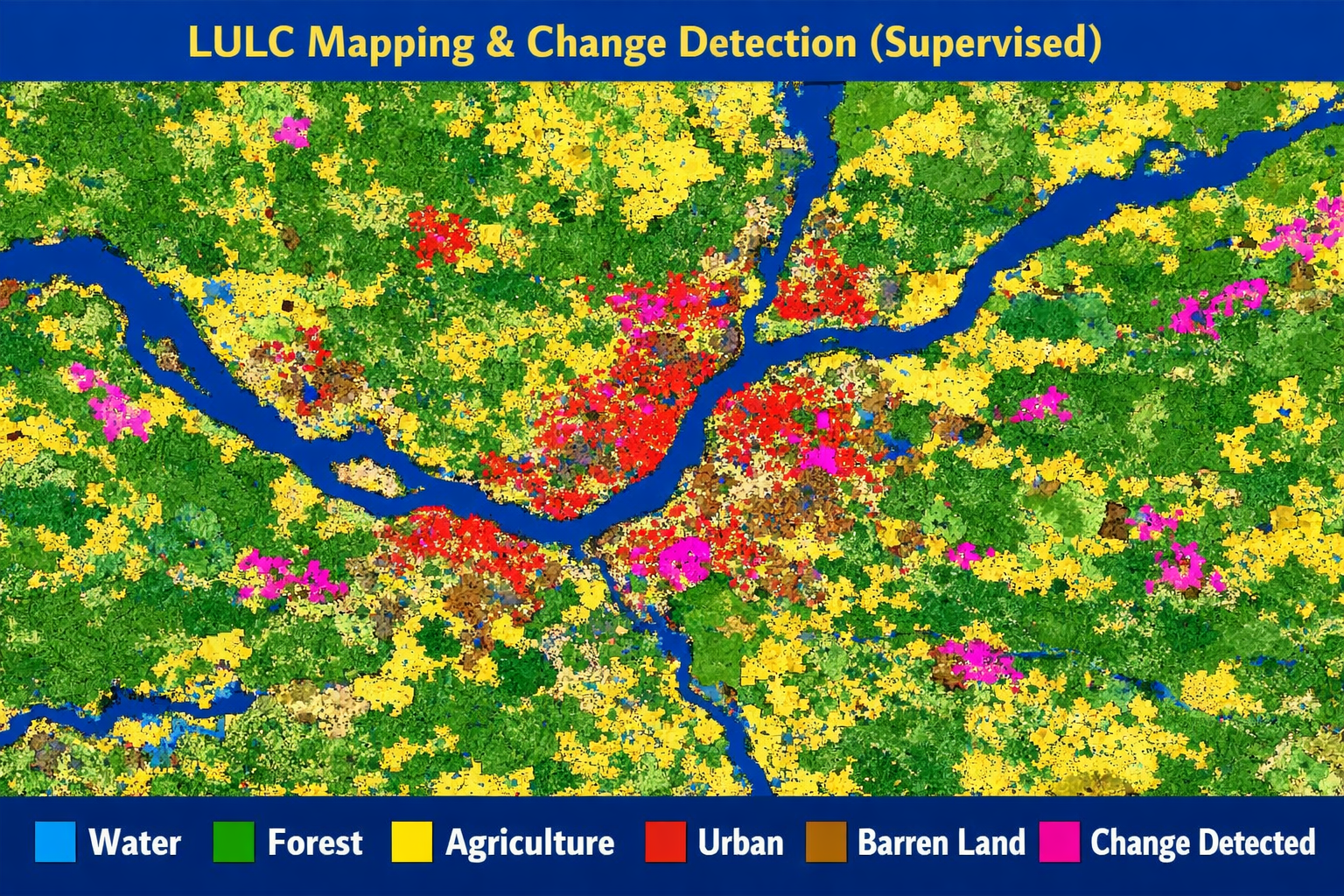
Land Use Land Cover mapping is carried out using high-resolution satellite and drone imagery. LULC mapping identifies different land categories such as forests, agriculture, water bodies, and urban areas using GIS and remote sensing techniques. Change detection analysis uses multi-temporal data to monitor land changes over time, supporting better planning, environmental monitoring, and sustainable resource

Geospatial analysis for River morphology studies, Watershed management, Climate and environmental analysis, Disaster management mapping.
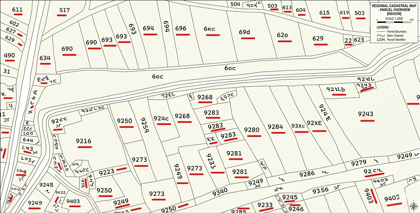
We provide cadastral mapping services including scanning, georeferencing, and digitization of land records. Using GIS technology, land parcel boundaries are accurately mapped and converted into digital formats. This helps in efficient land management, property identification, and integration with modern GIS-based land information systems.
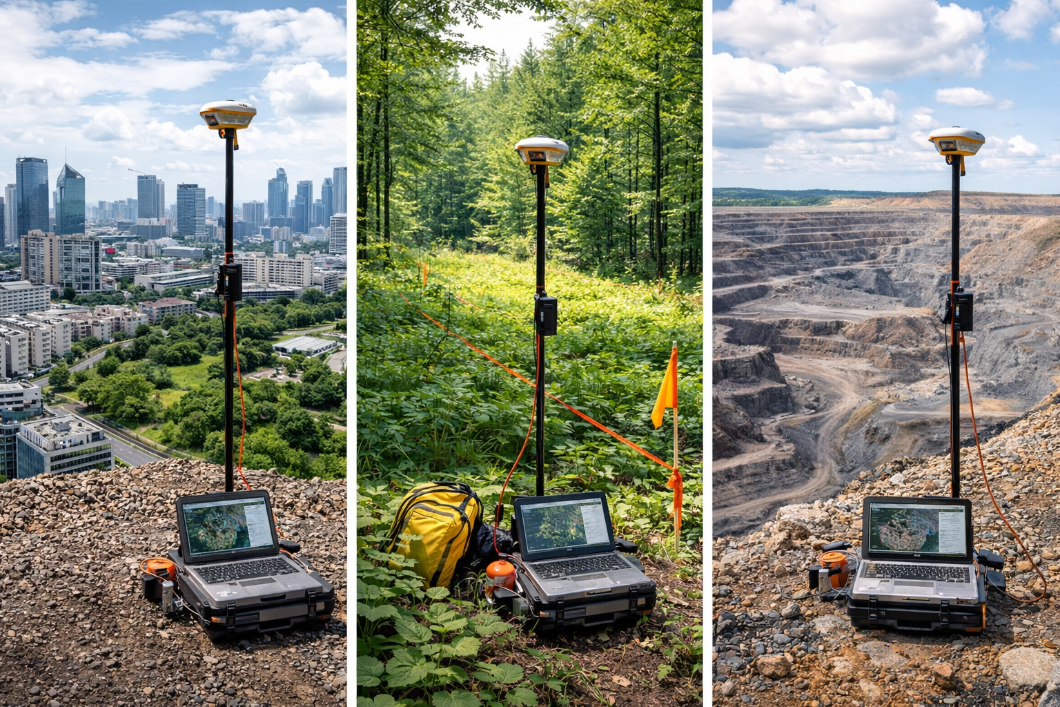
We provide high-accuracy mapping and ground truthing services using Differential GPS (DGPS) survey techniques. DGPS enables precise collection of geographic coordinates for control points, boundaries, and field verification. This ensures improved positional accuracy for GIS mapping, drone surveys, and geospatial data validation.
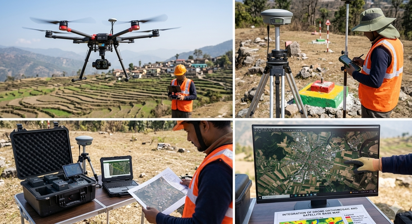
We provide high-resolution drone survey and mapping services using advanced RGB and LiDAR sensors. The collected data is processed to generate accurate orthomosaic maps, Digital Elevation Models (DEM), and 3D terrain models. These outputs support infrastructure planning, mining surveys, environmental monitoring, and detailed site analysis.
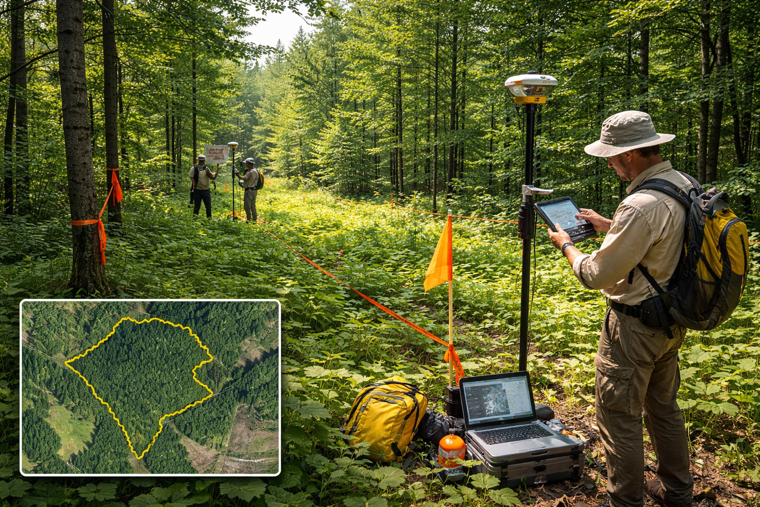
DGPS and drone/satellite imagery mapping are used to identify and demarcate forest boundaries with high precision. This helps reduce boundary disputes and conflicts between different stakeholders while supporting accurate forest management and monitoring.
Showcasing our expertise in geospatial analysis, drone surveying, and land record management.
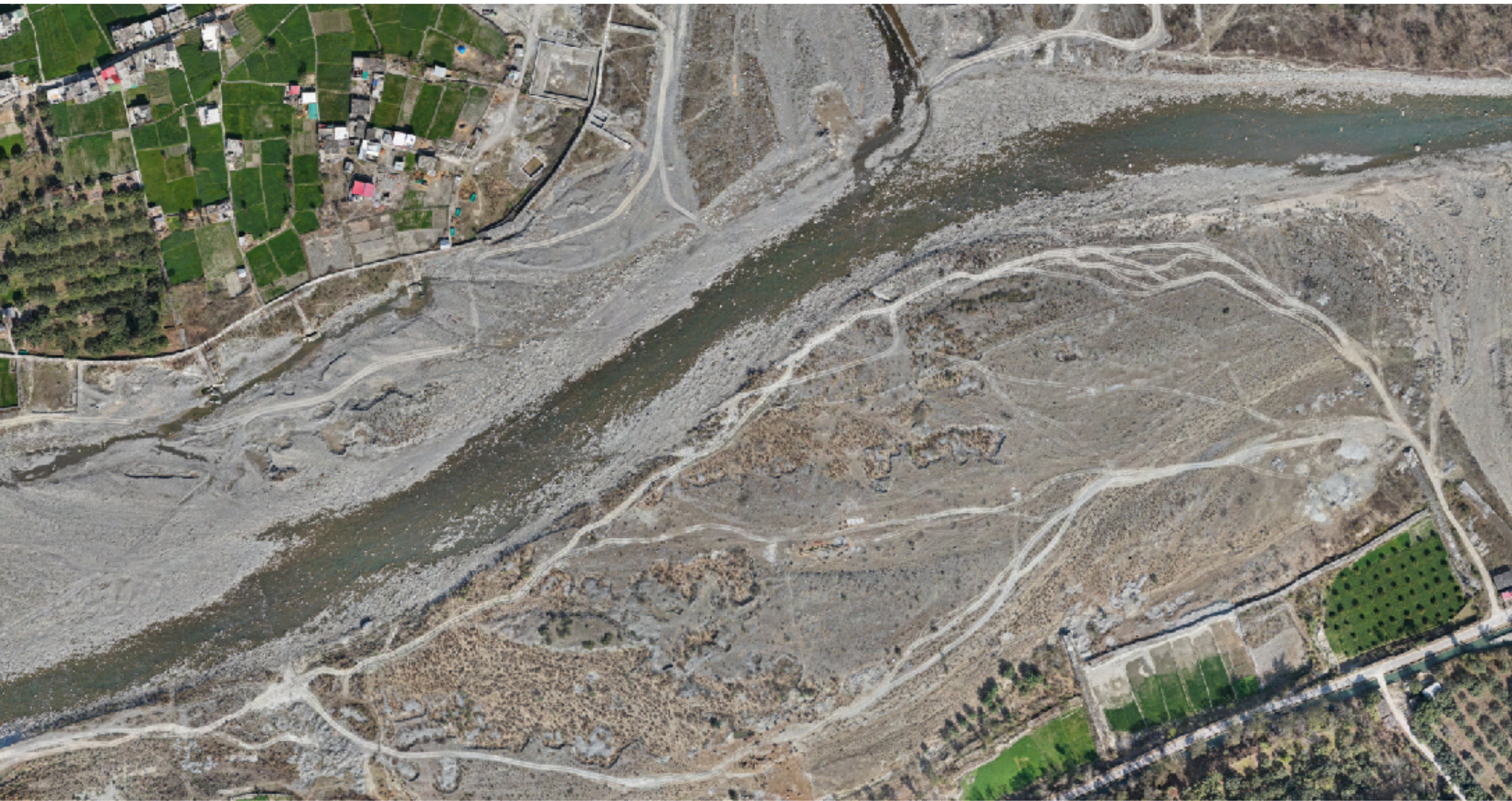
Drone survey and DGPS mapping of riverbed mining lease areas to verify boundaries and generate accurate DEM.
High-resolution drone imagery (2–3 cm GSD) was captured for the riverbed and adjoining areas to identify mining lease pillars and verify lease boundaries. Orthomosaic images and Digital Elevation Models (DEM) were generated from the drone data. Cadastral maps were georeferenced and overlaid with the orthomosaic to digitize land parcels and identify corresponding Khasra details and reference points. The project also included volumetric analysis of riverbed sand by comparing DEM datasets from different time periods, followed by preparation of final maps and technical reports.
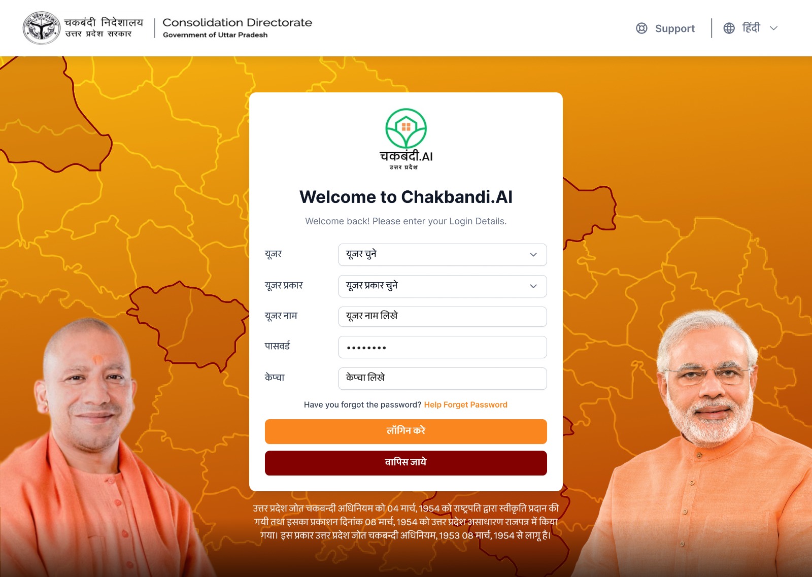
GIS based land record management with cadastral map digitization and WebGIS portal development.
This project aims to streamline land ownership by consolidating fragmented land parcels owned by individuals. It involves updating historical land records such as Khasra and Khatauni in GIS format, assessing exchange ratios, and producing a finalized and updated land parcel map containing all relevant information. The cadastral maps are first scanned and then georeferenced using Ground Control Points (GCPs) obtained through DGPS surveys. After georeferencing, parcel boundaries are digitized and attribute information is integrated into the GIS database. The final WebGIS portal utilizes this spatial and non-spatial data to empower landowners with accurate information about their land holdings and the current valuation of their land. This system supports better decision-making and ensures transparency in land management and land transactions.
Our mission is to deliver innovative GIS and remote sensing solutions that support accurate mapping, spatial analysis, and data-driven decision making. We aim to help governments, industries, and organizations manage resources efficiently and plan sustainable development.
Our vision is to become a trusted provider of advanced geospatial technologies, delivering reliable GIS, satellite, and drone-based solutions that empower better planning, environmental monitoring, and infrastructure development.
Leading the way in Geospatial Excellence and Innovation